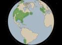
Explore the dynamics of our changing planet over the past three and a half decades.

A visualization of satellites, debris, and other objects tracked by LeoLabs in low earth orbit
This website shows a map of reddit. Each dot is a subreddit. Two dots within the same cluster are usually close to each other if multiple users frequently leave comments on both subreddits
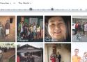
Travel Remotely - Travel from home
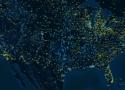
Watch the path of a raindrop from anywhere in the United States.
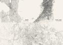
This website allows you to select a city and then draws every single road on a screen.
Live view of Starlink internet satellites and coverage.
TeleGeography's comprehensive and regularly updated interactive map of the world's major submarine cable systems and landing stations.
地铁数据库:提供中国地铁客流量查询,北京地铁客流查询,上海地铁客流查询,广州地铁客流查询,深圳地铁客流查询,成都地铁客流查询,南京地铁客流查询,武汉地铁客流查询,重庆地铁客流查询,西安地铁客流查询,长沙地铁客流查询...
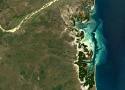
Air travel has been in existence for over one hundred years. Since its inception, thousands of airports runways have been built – each one of them designed site specifically, and according to landscape and natural conditions.
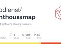
OpenStreetMap's Blinking Beacons.
Live Marine Traffic, Density Map and Current Position of ships in TAIWAN STRAIT
五级行政区划查询和下载网是一个提供中国从2010年到2023年的省市县乡村五级行政区划数据查询和下载的免费网站,省级矢量、市级矢量、县级矢量、乡镇级矢量和村级矢量
谷歌地图的 MyMaps 本身用于做行程规划,但是用来记录自己的旅行足迹似乎也是一个不错的玩法。